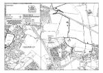
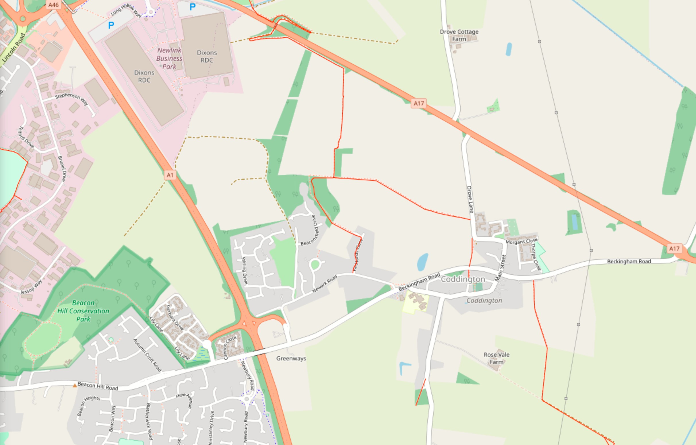
Public footpaths in Coddington, from https://footpathmap.co.uk:
Non-definitive map of rights of way in the wider area around Coddington, on the OS map, from http://www.rowmaps.com:
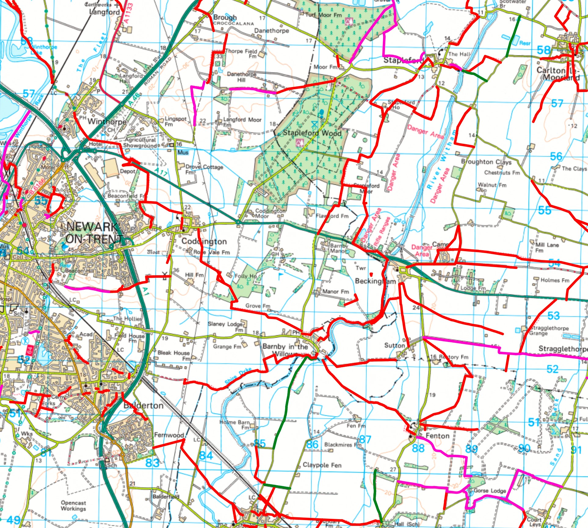
Explanation
The coloured lines show the rights of way.
The following colours are used for the coloured lines:
solid red line: footpath;
solid fuchsia line: bridleway;
solid green line: restricted byway;
solid blue line: byway open to all traffic.
If you click on a coloured line, some details about that right of way will appear.
Credits and small print
The map on this web page has been generated by www.rowmaps.com. The underlying map is provided by OS OpenSpace and this is © Crown copyright and database rights 2012 Ordnance Survey. Data containing details of the rights of way have been released under licence by the relevant councils. An authority’s Definitive Map is the authoritative source of their rights of way. The details of the public rights of way network contained in an authority’s data are for information only, and are an interpretation of the Definitive Map, not the Definitive Map itself, and should not be relied on for determining the position or alignment of any public right of way. This data is used to generate the coloured lines.